Heavy, continuous rains in 2025 have caused severe flooding in many areas of Hanoi, paralyzing traffic and disrupting residents’ daily lives.
As the urban drainage system reveals clear limitations under the pressure of urbanization and climate change, the solution to flooding cannot be limited to just increasing the capacity of sewers and pumping stations. A comprehensive approach is needed, spanning from planning and infrastructure to urban space.
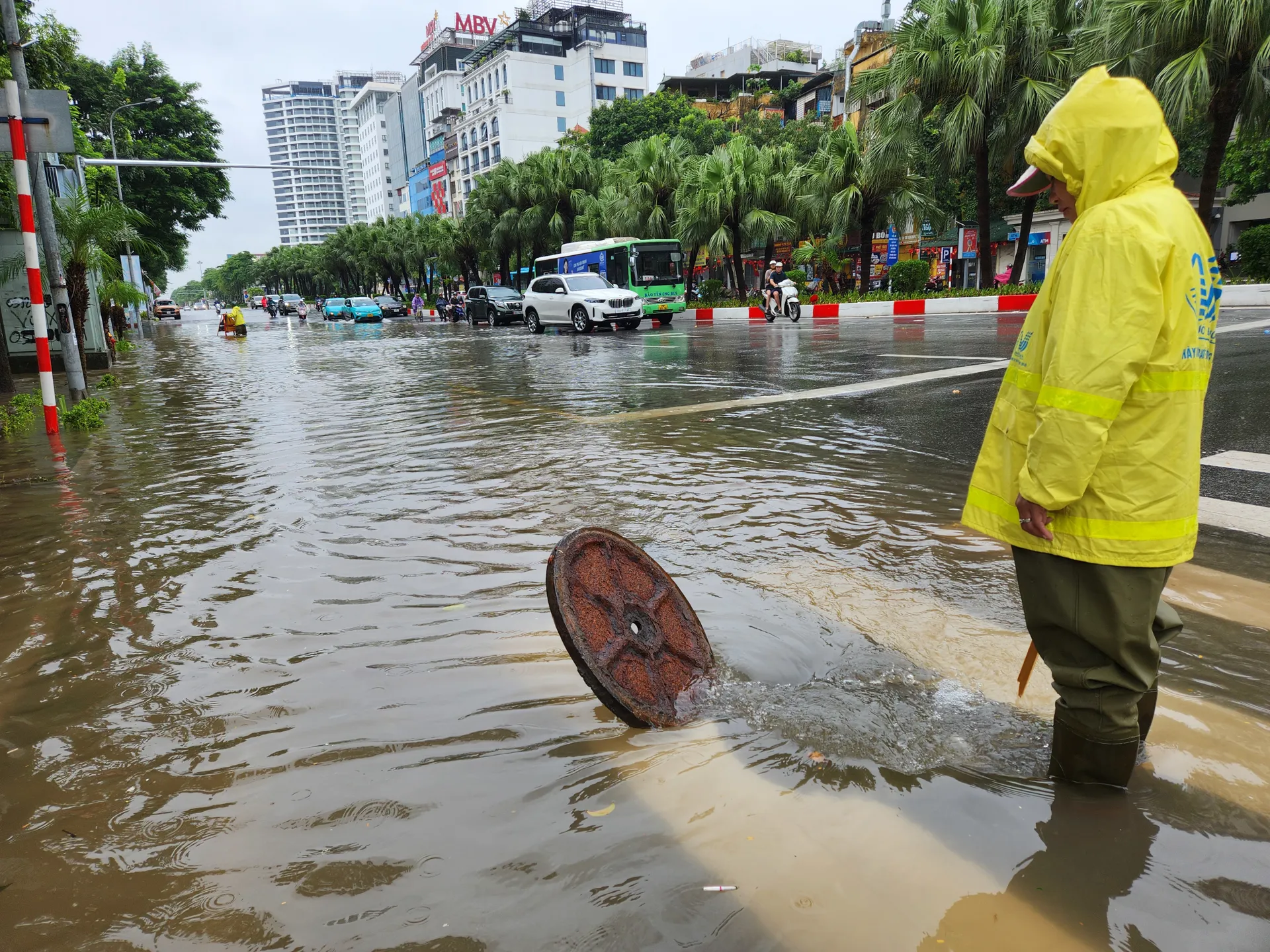
The flooding situation is not only occurring in traditional low-lying areas but has also spread to newly developed zones, which were expected to have synchronized infrastructure. The heavy rains this year are not just an extreme phenomenon of climate change but also point to gaps in Hanoi’s adaptive capacity.
Current temporary solutions often focus on improving drainage capacity. However, viewing flooding only from a drainage engineering perspective addresses just the symptoms of the problem. Reality shows that even when pumping systems operate at full capacity – as during the rain on September 30, 2025, when the Yen So Station operated all 20 pumps – there is still no way out. “When concrete overwhelms permeable surface areas, when ponds and lakes – natural ‘water reservoirs’ – are filled in to make way for high-rises, and when new urban areas inadvertently become artificial embankments blocking drainage paths, then flooding is the inevitable consequence of a development process that lacks respect for hydrological laws. It is time for Hanoi to adopt a new planning mindset; the city needs to ‘live with water’ rather than just ‘fight against water.'”
Sharing a similar viewpoint, it is recognized that the urban drainage system has not been invested in synchronously according to planning. The inner-city area covers over 313 square kilometers, but currently only about 77.5 square kilometers in the To Lich river basin have a relatively complete drainage system, accounting for less than 25% of the area. The Ta Nhue, Huu Nhue, and North of the Red River basins are still in the process of preparation or investment implementation.
According to leadership, the primary cause of flooding in Hanoi is rainfall far exceeding the system’s drainage capacity. Many rain events have an intensity nearly double the design capacity, causing the entire system to be overloaded. Additionally, water levels in rivers on Hanoi’s outskirts have risen above warning levels, including the Nhue River at the Thanh Liet dam reaching about 5.7 – 5.9 (higher than the planned control level of 4.5) and receding slowly. Meanwhile, the ground elevation in some urban areas and residential zones within the Ta Nhue and Huu Nhue basins is at a level of 5 – 5.5, making gravity drainage impossible and leading to waterlogging. The agricultural drainage system – which is a primary outlet for the city – has not been renovated to meet urban drainage requirements. Furthermore, many planned key projects, pumping stations, and regulating lakes have not been invested in or are not operating at full design capacity.
In addition, rapid urban development, lacking synchronization in ground levels between new urban areas and existing residential zones, along with internal drainage infrastructure not being effectively connected to the general system, has increased the risk of localized flooding.
Prolonged, high-intensity rainfall, combined with high tides and sea-level rise, has turned urban flooding into a systemic issue in Vietnam’s major cities. The traditional drainage system (gray infrastructure) is gradually revealing its limitations under the pressure of urbanization and extreme weather. In this context, urban green spaces need to be reconsidered as a core component of green infrastructure.
Unlike the traditional view that sees greenery merely as decorative, modern urban planning views green spaces as a sustainable stormwater management solution. Green spaces perform many important hydrological functions, helping to reduce surface runoff and regulate rainwater.
Organizing urban green spaces not only meets landscape and aesthetic requirements but is also an important strategy for cities to adapt to flooding and climate change. Green space planning must move beyond mere landscaping to become a core component of green technical infrastructure. Integrating drainage and rainwater regulation functions into the structure of green spaces will help create hydrological buffer zones capable of infiltration, water storage, and slowing surface runoff.
A new approach to flood prevention and control is proposed: retain water upstream, reduce flooding midstream, and prevent flooding downstream. Thus, the urban drainage system must