Medanbisnisdaily.com-Sidikalang. The Diakonia Pelangi Kasih Foundation (YDPK) has reaffirmed its rejection of the planned mining operations of PT Dairi Prima Mineral (PT DPM) in Dairi Regency. The opposition, voiced since 2008, is considered non-negotiable due to the significant threat of ecological disaster looming over the area.
The Advocacy Division of YDPK stated that legally and geographically, the Dairi Regency area, especially Silima Pungga-Pungga District, is unsuitable for mining.
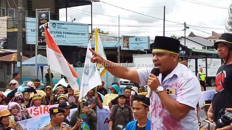
“YDPK asserts that legally and geographically, the Dairi area, particularly Silima Pungga-Pungga District, is completely unfit for mining,” said a representative during a demonstration at the Dairi Regent’s Office on Thursday, June 4, 2026.
According to them, this stance is reinforced by several court rulings that mandate the area’s protection. YDPK also believes the process of revising and amending PT DPM’s Environmental Impact Analysis (AMDAL) is fraught with irregularities and alleged data manipulation.
At least three significant findings were revealed in the company’s AMDAL documents.
First, the 2019 AMDAL document included references to salt ponds and mangrove forests in the Dairi area. In reality, Dairi Regency is a mountainous region far from coastal areas.
Second, the 2022 AMDAL document claimed the company had coordinated with a geologist regarding the Angkol method to ensure mine safety. However, upon confirmation, the named individual denied involvement in the document’s preparation.
Third, the company reportedly claimed it would not build a large tailings dam above ground because it would use the back-filling method, returning waste into underground mine cavities.
“In reality, the back-filling method can only contain about 50 to 60 percent of the waste. The remaining 40 to 50 percent must still be stored above ground, directly on an active earthquake fault line,” the representative explained.
YDPK also outlined three main reasons why PT DPM’s mining activities should be permanently stopped.
First, the mining concession is located in an earthquake-prone area crossed by the active Sumatra fault line, posing a high risk of geological disasters.
Second, the mining activity is deemed to contradict Regional Regulation Number 7 of 2014 concerning the Regional Spatial Plan (RTRW). Silima Pungga-Pungga District is a sustainable food agriculture area that cannot be converted.
Third, the potential disaster would not only impact Dairi Regency. If the tailings dam were damaged by an earthquake, at least 11 villages and 57 hamlets could be affected. Environmental damage could even spread to Pakpak Bharat Regency and Subulussalam City, Aceh.
YDPK noted that the people of Silima Pungga-Pungga still carry trauma from past environmental damage events.
In 2012, a waste leak was reported in the area. Meanwhile, in 2018, a flash flood struck the region, killing seven residents.
Given these conditions, YDPK criticized the government, including the Ministry of Environment and Forestry (KLHK), for not seriously evaluating the various ecological disasters occurring on Sumatra Island.
“The state must allocate up to IDR 101 trillion to address disasters in Sumatra. Is the mining sector’s contribution, which only accounts for about 10 percent of the regional GDP, comparable to the cross-generational environmental damage it causes? Clearly not,” the representative emphasized.
As an alternative development path, YDPK urged the government to focus more on strengthening the agricultural sector, which has long been the community’s livelihood source.
According to them, the mining sector has the potential to damage biodiversity and threaten residents’ livelihoods, while agriculture has proven to be safer, fairer, and more sustainable.
YDPK noted that the agricultural sector contributes approximately 42 percent to the regional