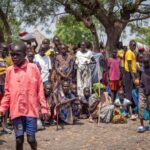
The region is experiencing rapid climate changes that have affected the lives of its inhabitants. Since the drought and famine of 1968-1975, followed by waves of desertification and floods, the region has been living through successive crises. Water sources have dried up, vegetation cover has receded, and rain-fed agriculture, on which the region’s population depends, has been impacted. This has resulted in waves of displacement and conflicts between communities, especially between herders and farmers. Conflicts over pastures and water have turned into ethnic and religious conflicts, later evolving into open wars.
The United Nations has warned that countries in the Sahel region are at risk of decades of armed conflict and displacement due to rising temperatures, resource scarcity, and instability. Floods, droughts, and devastating heatwaves are diminishing access to water, food, and livelihoods, amplifying the risks of conflict.
Climate Disruption and the Cost of Environmental Fragility
Although industrial nations are the main drivers of global warming and severe climate changes, and despite the African continent contributing no more than 4% of global greenhouse gas emissions, African countries are among the most affected by the catastrophic consequences of climate change. These consequences are causing a decline in Africa’s rich environmental biodiversity, contributing to increased food insecurity, displacement, migration, and conflicts over land.
The African Sahel region has witnessed severe climatic fluctuations, the frequency of which has increased over the past twenty years. The most prominent manifestations include:
- Rising Temperatures and Heatwaves:
During 2025, the African Sahel region experienced record temperatures and exceptional heatwaves. The region is classified as one of the most vulnerable to the repercussions of climate change in the world. Countries such as Mali, Niger, Burkina Faso, Chad, and Nigeria recorded temperatures 0.7 to 1.5 degrees Celsius above average. Parts of Burkina Faso and Mali experienced a severe heatwave in March 2025, with daytime temperatures exceeding 40 degrees Celsius, an increase of 6 degrees above the normal average for that time of year.
- Changing Rainfall Patterns and Floods:
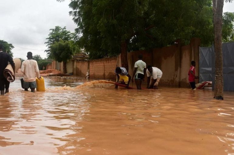
Rainfall is now concentrated in short periods, causing destructive flash floods. It has become rare for the period between June and September to pass without the region experiencing floods that lead to material damage and humanitarian tragedies.
After long drought cycles, rainfall has begun to return to its average level in the region, but with a clear increase in its temporal intensity without an improvement in the length of the rainy season compared to the drought years of the 1960s and 1970s.
The reality is that floods and heavy rains are no longer a surprise for the inhabitants of the Sahel. Many of its cities have been hit by devastating floods in recent years, including Niamey (the capital of Niger) which experienced floods in 2010, 2012, 2013, 2016, 2017, and 2022, as well as the Burkinabe capital, Ouagadougou, which also witnessed floods in 2009, 2012, 2015, 2020, etc.
The Nigerian capital, Abuja, was also affected by floods in September 2020, with water inundating several neighborhoods and destroying thousands of hectares of farmland.
The same applies to the Senegalese capital, Dakar, in 2022. The year 2024 represented another year of weather shocks in the Sahel region, with several areas experiencing destructive floods and flash floods. In Chad, flash floods and heavy rains led to the deaths of about 600 people and affected two million others, more than 10% of the country’s population.
In July 2025, rainfall amounts exceeding the normal average (up to 200% above normal) were recorded in wide areas of the Sahel, particularly in Senegal, Burkina Faso, Niger, Benin, and Nigeria. Water levels in major rivers (Niger, Senegal, Chari, Volta) are rising rapidly and alarmingly, having already exceeded warning levels in Niamey and other water measurement stations.
The floods have caused severe human and material damage. In Nigeria, 25 deaths and more than 5,500 displaced persons were recorded in Adamawa State. In Guinea, 34 deaths have been recorded since the start of the rainy season, including 18 deaths in one night in Conakry. In Mali, Niger, and Senegal,