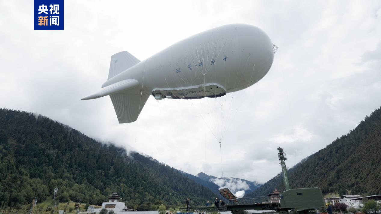
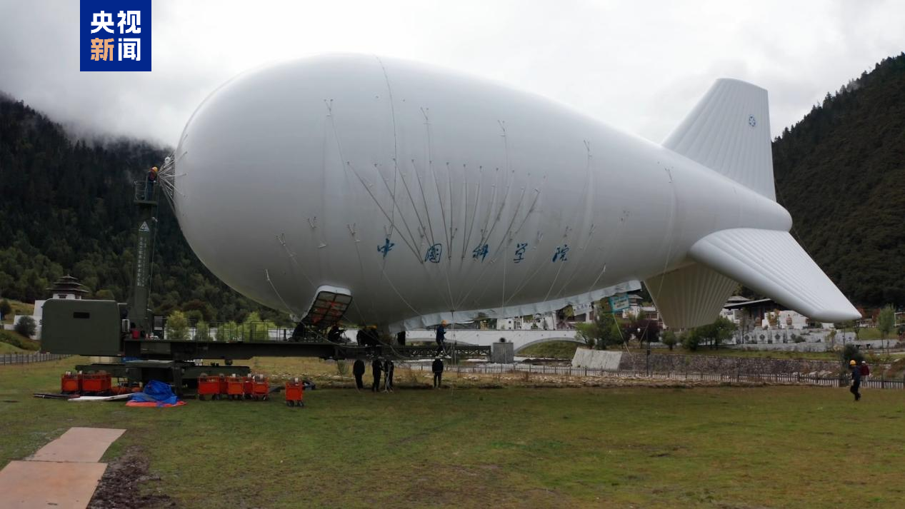
According to the Aerospace Information Research Institute of the Chinese Academy of Sciences, the scientific research team for the Second Tibetan Plateau Scientific Expedition recently successfully conducted an atmospheric observation experiment using the “Jimu-1” aerostat in the Lulang area of Tibet. Through coordinated multi-payload observations, the experiment achieved a technological leap from single-point sampling to three-dimensional monitoring for the aerostat.
During the experiment, the “Jimu-1” aerostat, carrying 16 types of scientific payloads across three major categories with a total weight of approximately 200 kilograms, successfully ascended to an altitude of 5,500 meters. The test accurately captured key scientific data, including atmospheric composition, pollutant distribution, and three-dimensional cloud microphysical parameters. This data will provide core support for research on the Tibetan Plateau, aiding in the in-depth analysis of the patterns of climate and environmental change on the plateau. It will also lay the foundation for dynamic monitoring and sustainable development in this region and other areas sensitive to global climate change.
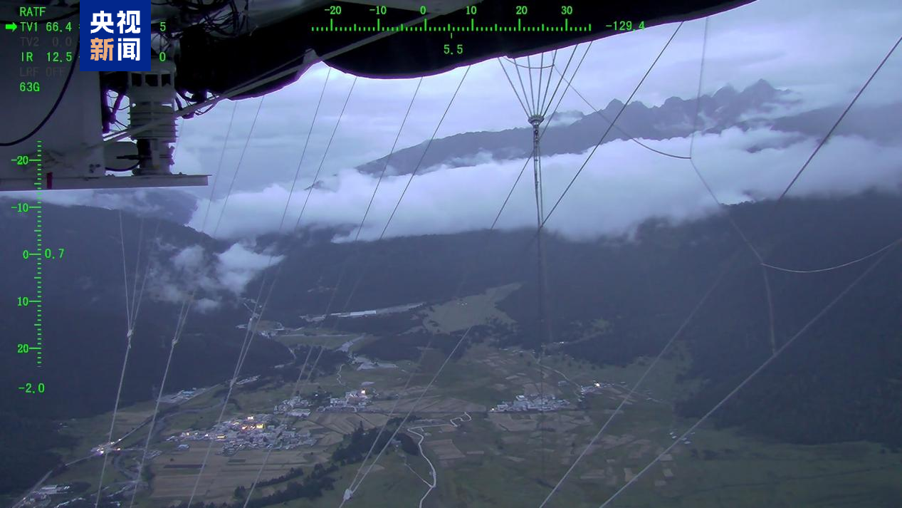
The observation payloads for the “Jimu-1” aerostat were jointly developed by multiple research institutions of the Chinese Academy of Sciences, with support from the “Dynamic Changes and Impacts of the Asian Water Tower” mission of the Second Tibetan Plateau Scientific Expedition. The core advantages of this aerostat lie in its high payload capacity, ultra-long endurance, strong anti-interference performance, and high adaptability to complex environments, allowing it to stably perform observation tasks under harsh working conditions. This experiment was conducted in the complex environment of the plateau, where the aerostat successfully overcame multiple challenges. It had to cope with sudden local strong convective weather, avoid the impact of turbulent airflow on the stability of the airship’s body, and endure sub-zero temperatures at high altitudes. From August to September 18, the experiment has cumulatively completed 29 ascent flight verifications, covering different altitude layers and meteorological conditions, providing a substantial amount of practical data for subsequent technological optimization.
It is understood that the aerostat has been participating in the Second Tibetan Plateau Scientific Expedition since 2017 and has successively carried out systematic scientific observations in core areas of the Tibetan Plateau, including Lulang, Nam Co, Mount Everest, Shuanghu, and Hoh Xil. By carrying various scientific observation payloads for meteorology, environment, geology, and other fields, the aerostat has assisted the scientific research team in obtaining massive amounts of high-quality observation data, effectively promoting scientific breakthroughs in the field of the Tibetan Plateau scientific expedition.