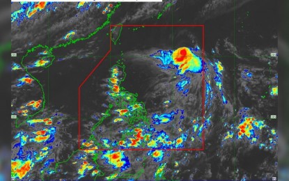
MANILA – Severe Tropical Storm (STS) Gorio has slowed down, moving west-southwest at 20 kilometers per hour (kph), but is still expected to leave the Philippine Area of Responsibility (PAR) by Wednesday night, according to the latest weather bulletin.
As of 4 p.m., Gorio was located 1,060 km east of extreme Northern Luzon.
The storm maintained its strength, with maximum sustained winds of 110 kph near the center and gusts of up to 135 kph.
Gorio is unlikely to affect the country in the next three days but may cause moderate sea conditions along the coastal waters of extreme Northern Luzon.
Small boats are advised to take precautions when venturing out to sea.
Meanwhile, the southwest monsoon (“habagat”) will continue to bring rain to several areas.
Isolated rain showers or thunderstorms are possible over the Negros Island Region, Western Visayas, Zambales, Bataan, Cavite, Batangas, Occidental Mindoro, Romblon, and Palawan.
Other parts of the country may also experience isolated rain showers due to localized thunderstorms.