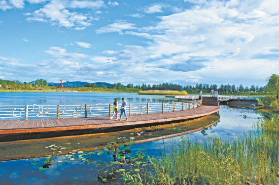
Beijing’s ecological conservation area has become a veritable “giant oxygen bar” and “giant garden.” The photo shows citizens and tourists strolling and sightseeing in Qinhu Park, Pinggu District.
Unfolding a map of Beijing, a vibrant stretch of green runs from the southwest to the northeast. The ecological conservation area, composed of the districts of Mentougou, Pinggu, Huairou, Miyun, Yanqing, and the mountainous areas of Fangshan and Changping, accounts for over half of Beijing’s land area and is a true “giant oxygen bar” and “giant garden.”
Over the past five years, this “giant oxygen bar” has become fresher and the “giant garden” more beautiful, with the ecological conservation area (five districts) adding over 100,000 mu of greenery. At the same time, clear waters and green mountains are being transformed into economic value, green momentum is rapidly gathering, and infrastructure and public services vital to people’s livelihoods are being improved in quality.
Sharing Greenery with Citizens: Greenways Connect the Beautiful Beijing Suburbs
In early spring, sunlight glitters on the Guishui River, and the air carries a moist, earthy scent as plants along the banks begin to “awaken.” While temperatures are still a bit low, more residents are coming out for morning exercise, working out along the waterfront promenade while enjoying the scenery.
“I’ve calculated it; it’s exactly 5,000 steps from my home to Xiadu Park,” said a Ms. Guo, a resident living by the Guishui River, who exercises along the path for an hour every day. In October last year, the Guishui River Waterfront Fitness Trail was completed, stretching over 21 kilometers, connecting four major urban parks, and eliminating 10 previous breaks in the path.
As a waterfront trail, special attention was paid to “water-friendly” features. Under safe conditions, the waterfront sections were designed to bring people as close to the water as possible. Some areas have water-access steps suitable for viewing, while other embankments use gentle slopes and planted grass instead of retaining walls, creating a more natural shoreline.
The ecological conservation area is Beijing’s natural oxygen bar. Over the past five years, it has added over 100,000 mu of forest and green space, with its forest coverage rate increasing from 66% to 66.69%.
With more greenery, it’s even more important to share it with citizens. Greenways are “green corridors” that make it easy for people to get close to nature. A relevant official stated that in recent years, the city has promoted the construction of forest trails such as the Xishan Mountain trails for panoramic views, the colorful Nanshan trails in Miyun, and the Great Wall viewing trails in Yanqing. Regarding opening up waterfront spaces for shared use, besides the completion of the Guishui River Waterfront Fitness Trail system, Mentougou District has also completed the greening of 125,000 square meters along the Yongding River and the renovation of three pocket parks.
Calculating the Clear Account: Ensuring Protectors Are Not Shortchanged
Just after the Spring Festival, Yanqing District’s GEP-R management platform was updated, allowing all 18 of its subdistricts and towns to precisely identify areas with potential for GEP-R improvement through the platform.
Gross Ecosystem Product (GEP) is the total monetary value of all ecosystem products within a certain region during an accounting period. Among its components, Ecosystem Regulation Service Value (GEP-R) represents the benefit value provided by ecosystems for maintaining or improving the human living environment, including ten indicators such as water conservation and climate regulation. Planting a tree, sowing a patch of grass, or cleaning a body of water can all contribute to an increase in GEP-R.
A plot of land near the Jingxin Expressway caught everyone’s attention. “Through system patch comparison, there are signs of vegetation degradation here,” explained the person in charge of GEP-R work. On the platform’s latest base map, this plot is classified as a “quality improvement” patch, requiring increased greenery to enhance vegetation quality. A rough estimate suggests that after quality improvement, this patch’s GEP-R could increase by tens of thousands of yuan.
Last year, Yanqing District took the lead nationally in launching a “One Map” platform for GEP-R management. By comparing ecosystem classification maps, the platform precisely identifies three types of patches across the district: “quality improvement” patches focus on restoring degraded ecological vegetation