According to meteorologists, Typhoon No. 15 (Koto) is moving slowly and erratically due to a weakening subtropical high-pressure system, combined with cold air moving down, so its direction and intensity are still subject to change.
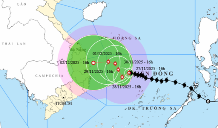
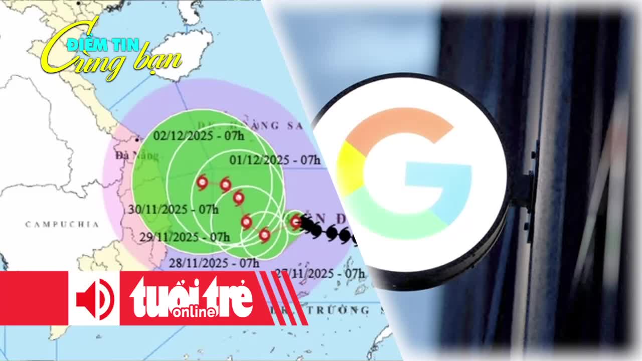
According to the National Center for Hydro-Meteorological Forecasting on the afternoon of November 27, the storm’s center is about 230km northwest of Song Tu Tay Island. The maximum wind speed near the storm’s center is at level 12 (118-133 km/h), with gusts reaching level 15.
The typhoon is currently moving slowly westward at a speed of 5-10 km/h.
The latest forecast from the meteorological agency indicates that in the next 24 hours, the typhoon is likely to change direction to the west-southwest and continue moving even slower (about 3-5 km/h), while maintaining its intensity at level 12.
Subsequently, the typhoon is likely to change direction to the north-northwest and continue moving slowly at 3-5 km/h, with its intensity likely beginning to gradually weaken.
In the following days, the typhoon is expected to deviate northward, then change direction again to the west while its intensity continues to weaken gradually.
It is highly likely that by the time it reaches the waters from Quang Ngai to Gia Lai on December 2, the typhoon will weaken into a tropical depression.
Explaining the reason for the typhoon’s slow and erratic movement, a meteorologist stated that the subtropical high-pressure system – the main factor controlling the typhoon’s path – east of the Philippines is showing signs of weakening.
Secondly, as the typhoon approaches the central mainland, it moves farther from the subtropical high-pressure system and is no longer solely guided by this weather pattern, causing its speed to slow down and its movement direction to change.
“Regarding intensity, the typhoon is likely to maintain its strength today. After cold air moves down, increasing atmospheric pressure and creating winds between the cold air and the typhoon, it is likely to maintain intensity at levels 10-11.
However, when the typhoon moves close to the coast (around longitude 113-112), the sea surface temperature is significantly lower compared to the central South China Sea area, so the typhoon will begin to weaken. Once the typhoon has weakened, its impacts on intensity and trajectory will no longer be as clearly pronounced as when it first entered the South China Sea,” the meteorologist shared, adding that the typhoon’s development after November 28 remains relatively complex.
Currently, due to the influence of Typhoon No. 15, the central South China Sea area (including the sea area north of the Spratly Islands special zone) has strong winds at levels 7-9, with the area near the storm’s center experiencing levels 10-12, gusts up to level 15, sea waves 4-6 meters high, and the area near the storm center experiencing waves 7-9 meters high, with very rough seas.
From early morning through November 28, offshore waters from Gia Lai to Khanh Hoa will have strong winds at levels 6-7, later increasing to level 8, with gusts at levels 9-10, sea waves 5-7 meters high, and very rough seas.
Ships operating in the aforementioned dangerous areas are all likely to be affected by thunderstorms, tornadoes, strong winds, and large waves.
The circulation of Typhoon No. 15 (Koto) and the cold air mass could cause moderate to heavy rain in the area from Da Nang to Lam Dong, with a very high risk of continued landslides, flash floods, and flooding in low-lying areas in this region.