This year’s September 2nd holiday, people have four consecutive days off, from today until the end of September 2nd. Therefore, many are taking the opportunity to return to their hometowns or travel, making traffic busier and increasing the risk of traffic jams in many sections.

Which areas are prone to congestion on the HCMC – Long Thanh – Dau Giay Expressway?

Vietnam Expressway Engineering Corporation Joint Stock Company (VECE – the management unit of the HCMC – Long Thanh – Dau Giay Expressway) stated that the expressway currently serves an average of nearly 68,000 vehicles per day, with peak days reaching nearly 90,000 vehicles.

The project to widen the HCMC – Long Thanh section was just launched on August 19th, with a high potential for congestion. It is forecasted that on the evening of August 30th, traffic volume from HCMC to Dau Giay will increase, while the opposite direction from Dau Giay to HCMC will peak on September 2nd, creating significant pressure.

Specifically, the section from An Phu Intersection to Long Thanh Bridge has a steep gradient, with only two lanes per direction. This area frequently experiences collisions or vehicle breakdowns.

Another point is at the intersection area – Long Thanh, connecting to the under-construction Bien Hoa – Vung Tau Expressway.

The section from Km41 to Km99, near the Phan Thiet – Dau Giay area, is also a place with very heavy traffic concentration. Here, vehicles from the Phan Thiet – Dau Giay Expressway merge into the HCMC – Long Thanh – Dau Giay Expressway, while the toll station only has two ETC lanes per direction.

To reduce traffic jams, VECE is coordinating with relevant units to prepare various remote traffic diversion methods. When traffic volume is excessively high or incidents occur on the HCMC – Long Thanh section, forces will immediately notify through channels such as VOV Traffic, electronic VMS boards, Zalo, Viber… to advise drivers not to enter the expressway.
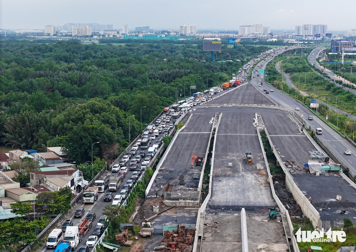
HCMC - Long Thanh - Dau Giay Expressway - Image 2.

How to escape expressway traffic jams

People are advised to choose alternative routes such as National Highway 1, High-Tech Park Road, Cat Lai Ferry, or beltways. Vehicles going to Vung Tau can exit the expressway from Do Xuan Hop (km3), Beltway 2 (km4), Beltway 3, or Intersection 319 (km19+700) to follow National Highway 51.

Especially, vehicles from National Highway 51 to HCMC are advised not to enter the expressway at branch A of the National Highway 51 intersection, but should go straight on National Highway 51 to avoid congestion.

If congestion occurs on the Long Thanh – Dau Giay section, vehicles also have other options. From Long Thanh to Dau Giay, one can avoid the expressway by taking Provincial Road 769 to Dau Giay Intersection. Vehicles from Dau Giay to Long Thanh, instead of entering the expressway, can take National Highway 1 or DT769 and then re-enter National Highway 51.

Specifically, vehicles from the Phan Thiet – Dau Giay Expressway encountering congestion at the toll station Km94+450 can detour via National Highway 56 – National Highway 1 to reach Dau Giay and Long Thanh. If already on the expressway but congested at branch N4

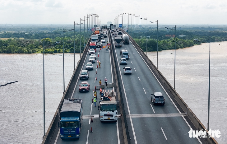
Long Thanh Bridge

Long Thanh Bridge is a modern cable-stayed bridge in Vietnam, completed in 2018 to alleviate traffic congestion. It spans the Dong Nai River, connecting the city of Bien Hoa with Long Thanh International Airport. Its construction was a significant infrastructure project to support the economic development of the southern key economic region.

HCMC – Long Thanh – Dau Giay Expressway

The HCMC – Long Thanh – Dau Giay Expressway is a major transportation artery in southern Vietnam, connecting Ho Chi Minh City to Dau Giay. It was constructed to alleviate severe traffic congestion on the older National Highway 1 and officially opened to traffic in 2015. The expressway plays a crucial economic role by linking the city to key industrial zones and the future Long Thanh International Airport.

An Phu Intersection

An Phu Intersection is a major and notoriously congested traffic circle in the Thủ Đức district of Ho Chi Minh City, Vietnam. Historically a simple crossroads, it has grown into a critical but overwhelmed transportation hub due to the rapid urban development of the surrounding area.

Bien Hoa – Vung Tau Expressway

The Bien Hoa – Vung Tau Expressway is a major transportation project in southern Vietnam, designed to connect the key industrial hub of Bien Hoa to the vital seaport and tourist province of Ba Ria – Vung Tau. Its construction, which began in the late 2010s, aims to alleviate severe traffic congestion and boost regional economic development. The expressway significantly reduces travel time between these two important locations.

Phan Thiet – Dau Giay Expressway

The Phan Thiet – Dau Giay Expressway is a vital 99-kilometer transportation link in southern Vietnam, connecting Binh Thuan Province to Dong Nai Province and the greater Ho Chi Minh City area. It was officially opened to traffic in early 2023 to alleviate congestion, boost regional trade, and improve access to popular tourist destinations like Mui Ne.

National Highway 1

National Highway 1 is Australia’s longest highway, a coastal route that circumnavigates the entire continent for approximately 14,500 km (9,000 mi). Its history is tied to the federation of Australia in 1901, with the route being progressively assembled and upgraded from a collection of existing state roads to form a continuous national loop.

National Highway 51

National Highway 51 is a major north-south transportation artery in Vietnam, connecting the port city of Hai Phong in the north with the capital, Hanoi, and continuing southward. Historically, it has been a vital route for trade and military logistics for decades, playing a significant role during the periods of French colonial rule and the Vietnam War.

Cat Lai Ferry

The Cat Lai Ferry is a vital river crossing connecting Ho Chi Minh City and Dong Nai Province, operating on the Dong Nai River. Historically, it was a crucial transportation link before modern bridges were built, serving as a major gateway for goods and people. While its prominence has diminished with new infrastructure, it remains an important local ferry service.