Accuracy Exceeds 99%: China’s Meteorological Sounding System Fully Enters the Beidou Era
China’s meteorological sounding system has completed a comprehensive upgrade from L-band sounding to BeiDou-based sounding, marking the country’s advancement into the international forefront in the field of high-altitude meteorological observation. The overall data accuracy rate of the BeiDou sounding system exceeds 99%, and it has already been applied in areas such as weather forecasting and climate monitoring.
An internationally advanced BeiDou sounding observation network has been established
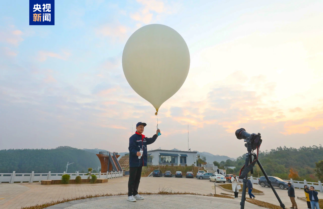
Currently, an integrated land-sea-air-space comprehensive meteorological observation system has been built. In the field of high-altitude meteorological observation, information about temperature, humidity, air pressure, and wind speed and direction at various atmospheric levels is primarily obtained by releasing balloons equipped with sounding instruments.
The upgraded BeiDou sounding system is a new-generation meteorological sounding system independently developed with international advanced standards. It can stably obtain more accurate vertical profiles of atmospheric temperature, humidity, air pressure, wind direction, and wind speed from the ground up to 30,000 meters.
BeiDou sounding data serves the world
Simultaneously, BeiDou sounding provides crucial support for in-depth participation in global meteorological observation, forecasting, and services. Currently, the 131 BeiDou sounding stations account for 12% of the global total number of sounding stations, with 88 of them serving as global data exchange stations. The shared data submitted by these stations represents approximately 11% of the global total, offering important reference data for global numerical weather prediction and addressing climate change.
L-band sounding system
The L-band sounding system is not a cultural site or place, but a type of remote sensing technology used in meteorology and Earth observation. It operates in the L-band frequency range (1-2 GHz), which is particularly effective for measuring soil moisture and ocean salinity because it can penetrate vegetation and soil. This technology was notably advanced by satellite missions like NASA’s SMAP (Soil Moisture Active Passive) and ESA’s SMOS (Soil Moisture and Ocean Salinity), launched to improve climate and weather forecasting models.
BeiDou-based sounding system
The BeiDou-based sounding system is a modern hydrographic surveying technology that utilizes China’s BeiDou Navigation Satellite System for positioning. It enables precise underwater depth measurements and terrain mapping by integrating satellite signals with sonar equipment. This system represents an advancement in maritime navigation and resource exploration, leveraging BeiDou’s regional (and now global) satellite coverage developed since the early 2000s.
BeiDou sounding observation network
The BeiDou Sounding Observation Network is a meteorological monitoring system in China that utilizes signals from the BeiDou satellite navigation constellation. It was developed to enhance atmospheric profiling by measuring parameters like temperature, humidity, and pressure through satellite signal refraction. This network supports weather forecasting and climate research, expanding on China’s broader BeiDou satellite infrastructure launched since the early 2000s.
land-sea-air-space comprehensive meteorological observation system
This is not a specific place or cultural site, but a technological infrastructure concept. It refers to a modern, integrated network of observation platforms—including ground stations, ocean buoys, aircraft, and satellites—designed to monitor the Earth’s entire climate system. Its development has accelerated since the mid-20th century to improve weather forecasting, climate research, and disaster warning capabilities.
high-altitude meteorological observation
High-altitude meteorological observation began with pioneering scientific expeditions in the 18th and 19th centuries to study mountain weather patterns. Today, it is a critical scientific practice that utilizes weather stations, balloons, and satellites to monitor atmospheric conditions at high elevations. This data is essential for weather forecasting, climate research, and understanding phenomena like global warming.
BeiDou sounding stations
BeiDou sounding stations are ground-based facilities that support China’s BeiDou Navigation Satellite System (BNDSS) by monitoring satellite signals, tracking orbits, and ensuring positioning accuracy. These stations form a critical part of the system’s ground segment, which was developed to provide an independent alternative to other global navigation systems like GPS. The network has expanded over time, reflecting China’s broader effort to achieve technological self-reliance in satellite navigation since the BeiDou program’s inception in the 1990s.
global data exchange stations
Global data exchange stations are physical infrastructure hubs where international internet traffic is routed and exchanged between networks. Historically emerging with the commercialization of the internet, they evolved from simple network access points (NAPs) into massive, secure facilities. These stations, often located in strategic coastal areas near undersea cable landing points, form the critical backbone of the global internet by enabling the seamless flow of data across continents.
global numerical weather prediction
Global numerical weather prediction is a scientific method that uses mathematical models of the atmosphere and oceans to forecast weather. Its modern history began in the mid-20th century, building on earlier theoretical work, with the advent of computers making complex calculations possible. Today, supercomputers run these global models, operated by centers worldwide, to provide essential forecasts for everything from daily weather to severe storm warnings.