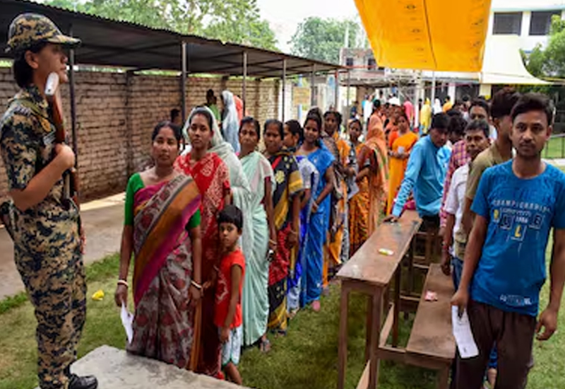
By 1:00 PM, the voter turnout in the first phase of the election was 62.18%. The first phase of the state assembly elections has been underway since Thursday morning. Isolated incidents of unrest are emerging in some places. In a few cases, the commission has taken a strict stance, but in most cases, they remain silent.
1 Mekhliganj 59.38
2 Mathabhanga 61.21
3 Cooch Behar North 62.87
4 Cooch Behar South 58.22
5 Sitalkuchi 60.19
6 Sitai 62.56
7 Dinhata 62.08
8 Natabari 61.42
9 Tufanganj 57.9
10 Kumargram 62.43
11 Kalchini 60.87
12 Alipurduar 58.83
13 Falakata 59.71
14 Madarihat 57.78
15 Dhupguri 60.97
16 Maynaguri 63.08
17 Jalpaiguri 56.23
18 Rajganj 61.99
19 Dabgram-Phulbari 59.07
20 Mal 61.97
21 Nagrakata 62.99
22 Kalimpong 59.52
23 Darjeeling 59.45
24 Kurseong 57.88
25 Matigara-Naxalbari 62.73
26 Siliguri 55.72
27 Phansidewa 62.26
28 Chopra 61.4
29 Islampur 60.09
30 Goalpokhar 61.01
31 Chakulia 56.88
32 Karandighi 62.5
33 Hemtabad 58.91
34 Kaliaganj 61.52
35 Raiganj 57.68
36 Itahar 59.22
37 Kushmandi 62.93
38 Kumarganj 62.56
39 Balurghat 61.65
40 Tapan 62.76
41 Gangarampur 64.92
42 Harirampur 63.16
43 Habibpur 59.7
44 Gazole 57.58
45 Chanchal 53.81
46 Harishchandrapur 57.83
47 Malatipur 58.86
48 Ratua 59.79
49 Manikchak 60.08
50 Malda 59.66
51 English Bazar 55.11
52 Mothabari 61.98
53 Sujapur 57.15
54 Baisnabnagar 61.33
55 Farakka 66.7
56 Samsherganj 71.07
57 Suti 68.86
58 Jangipur 66.66
59 Raghunathganj 70.29
60 Sagardighi 63.47
61 Lalgola 67.28
62 Bhagawangola 65.61
63 Raninagar 59.64
64 Murshidabad 59.87
65 Nabagram 61.98
66 Khargram 61
67 Barwan 62.37
68 Kandi 58.52
69 Bharatpur 60.41
70 Rejinagar 61.66
71 Beldanga 61.86
72 Baharampur 61.69
73 Hariharpara 58.13
74 Naoda 60.53
75 Domkal 59
76 Jalangi 60.55
203 Tamluk 63.77
204 Panskura East 59.64
205 Panskura West 64.05
206 Moyna 63.37
207 Nandakumar 66.11
208 Mahishadal 61.41
209 Haldia 59.97
210 Nandigram 65.46
211 Chandipur 61.71
212 Patashpur 65.29
213 Kanthi North 64.09
214 Bhagabanpur 63.88
215 Khejuri 62.92
216 K
Mekhliganj
Mekhliganj is a town in the Cooch Behar district of West Bengal, India, located near the border with Bangladesh. Historically, it was part of the princely state of Cooch Behar and later became a significant trading post due to its riverine location on the Dharla River. Today, it serves as a local administrative and commercial hub, with cultural ties to both India and Bangladesh.
Mathabhanga
Mathabhanga is a town in the Cooch Behar district of West Bengal, India, historically part of the princely state of Cooch Behar. It is known for its cultural significance and the Mathabhanga River, which flows through the area and influences local agriculture and daily life. The town also features landmarks like the Mathabhanga Rajbari, reflecting its historical ties to the region’s royal heritage.
Cooch Behar
Cooch Behar is a city in the Indian state of West Bengal, historically known as the capital of the princely state of Cooch Behar under the Koch dynasty. Its most famous landmark is the Cooch Behar Palace, built in 1887 in an Italian Renaissance style, reflecting the region’s rich cultural heritage and royal history. The area also features the Madan Mohan Temple and is known for its unique blend of Bengali and Rajput architectural influences.
Sitalkuchi
Sitalkuchi is a town and a community development block in the Cooch Behar district of West Bengal, India. Historically, it was part of the princely state of Cooch Behar before India’s independence, and its culture reflects a blend of Bengali and Rajbanshi traditions. The area is known for its rural landscape, agricultural economy, and local festivals that highlight its rich folk heritage.
Dinhata
Dinhata is a town in the Cooch Behar district of West Bengal, India, with a history deeply rooted in the princely state of Cooch Behar. It was once an important administrative and commercial center under the Koch dynasty, and later played a role in the region’s trade and cultural exchanges. Today, Dinhata is known for its agricultural economy and its proximity to the India-Bangladesh border.
Alipurduar
Alipurduar is a town in the Indian state of West Bengal, located near the Bhutan border and historically part of the Duars region. It served as a key gateway for trade and military operations during the British colonial period, particularly after the Anglo-Bhutan War in 1865. Today, it is known for its scenic beauty, wildlife, and as a cultural hub connecting the plains to the Himalayan foothills.
Darjeeling
Darjeeling is a hill station in West Bengal, India, known for its stunning views of the Himalayan mountain range, including Mount Kanchenjunga. Originally part of the Kingdom of Sikkim, it was developed by the British East India Company in the 19th century as a sanatorium and tea-growing region, leading to the establishment of the famous Darjeeling tea industry. Today, it remains a popular tourist destination and a UNESCO World Heritage Site for its Darjeeling Himalayan Railway.
Siliguri
Siliguri is a major city in the Indian state of West Bengal, serving as a key commercial and transit hub in the northeastern region. Its modern development began in the 19th century under British rule, when it grew as a strategic railway and trade center connecting the Indian subcontinent with Bhutan, Nepal, and Bangladesh. Today, Siliguri is known for its bustling markets, diverse population, and its role as the gateway to the Darjeeling Himalayas and other northeastern destinations.