Prolonged heavy rains in recent days have worsened landslide conditions in the mountainous areas of Quang Ngai. In many residential areas along rivers and streams, the soil is being deeply eroded hour by hour, putting dozens of households at risk of losing their homes and facing safety concerns as heavy rains continue.
For many days, over 120 households living along the Dak Snghe River section through Kon Skol village (Kon Braih commune, Quang Ngai province) have endured sleepless nights as floodwaters rise and landslides approach residential roads and housing areas. Each heavy rainstorm reignites fears of the river “eating away” at their homes.
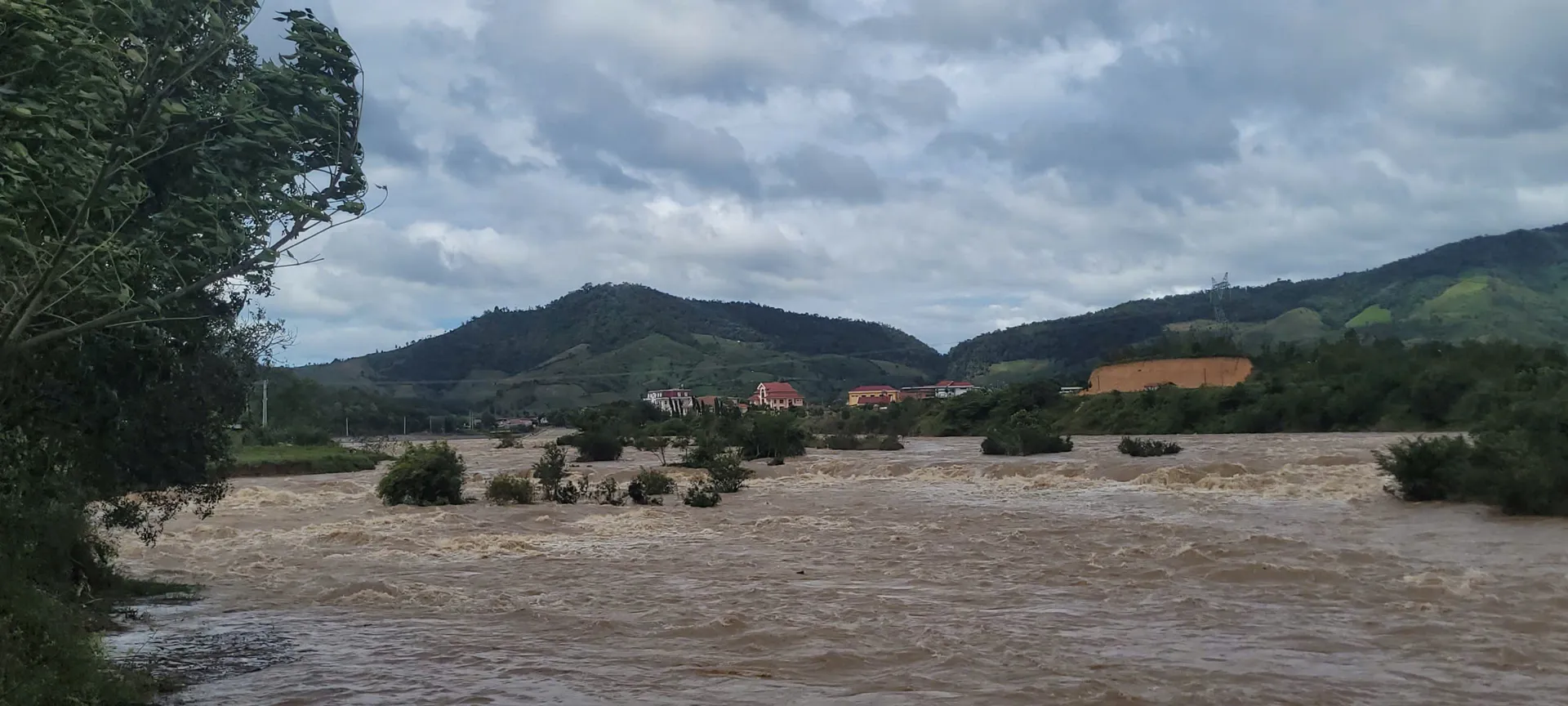
The Dak Snghe River flows through Kon Braih commune for approximately 2,500 meters. During the rainy season, water volume from upstream is very large. Particularly, Typhoon No. 13 (KALMAEGI) recently caused serious landslides on both riverbanks, with many sections approaching residential areas, posing high safety risks to lives and production during the flood season.
According to local authorities, landslides along the Dak Snghe River banks have been developing complexly for many years. During the recent storm period, rising river water swept away large areas of coffee, cassava, and fruit trees belonging to local residents.
Landslides approaching residential roads.
Worryingly, at many locations, floodwaters are only tens of centimeters away from residential roads. This is the only transportation route leading to the residential area. If this road is swept away, the entire Kon Skol village risks isolation during major floods.
A resident of Kon Skol village stated, “Every time we hear storm forecasts, the whole village becomes anxious: ‘Living close to the riverbank without embankments, the residential road could be swept away at any moment. During the recent Typhoon No. 13, floodwaters reached the road edge, sweeping away many crops. Local militia, police, and residents had to stay awake all night monitoring water levels, ready to report any abnormalities and evacuate if necessary.'”
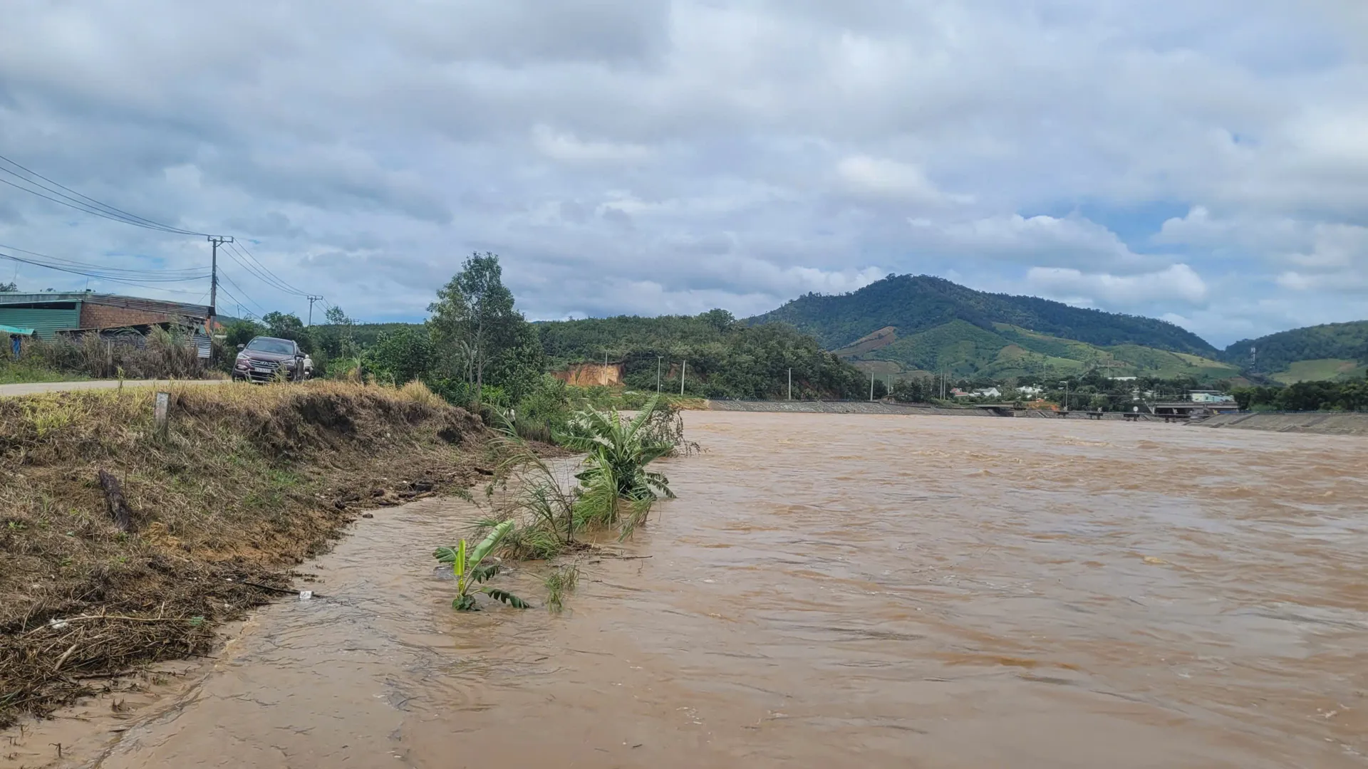
Not only threatening residential areas, landslides have also severely damaged the main road of Hamlet 10 – the only route leading to the production area of Kon Skol residents and neighboring hamlets. This road serves over 1,000 hectares of agricultural land, which is the main income source for the locality. If landslides continue, agricultural product transportation will be disrupted, significantly affecting residents’ livelihoods.
The Kon Braih commune chairman reported that recent storms caused unusually high water levels in the Dak Snghe River, resulting in serious landslides in the Kon Skol village area, threatening property and crops of over 120 households. Facing safety risks, the commune has developed plans to relocate approximately 35 severely affected households at direct risk to lives and property.
“The recent Typhoon No. 13 caused serious riverbank landslides, threatening residential areas. To protect residents and stabilize production, Kon Braih commune authorities urgently request the provincial government to allocate funding for constructing anti-erosion embankments along the Dak Snghe River,” the chairman proposed.
Not only at Dak Snghe, but the Dak Sia stream section flowing through National Highway 40B in Kon Dao commune (Quang Ngai province) also shows multiple serious landslide points. The ground foundation has been hollowed out, approaching house foundations and keeping many households in constant fear.
Landslides approaching residential houses.
A 59-year-old resident from Dak Tram hamlet reported that floodwaters from Typhoons No. 10 and 12 swept away part of her house foundation, cracked the floor, and washed away many fruit trees.
“Our house is close to the stream bank, so every storm season our family must stay awake all night monitoring water levels. We have repeatedly requested construction of embankments and rock gabions but lack funding,” she shared.
Another resident in Dak Tram hamlet faces similar conditions as landslides have reached the wall foundation. If stream water rises further, the house risks collapsing into the stream