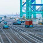
How to manage 30,000 drones flying simultaneously in the air? How to make cameras “take off” from the ground, weaving a dynamic monitoring network that covers the city’s “blood vessels”? Tianjin provides answers with a series of innovative solutions.
Yesterday, the construction promotion meeting for Tianjin’s Low-Altitude Flight Service Platform project was held. It was revealed that both the Tianjin Low-Altitude Flight Service Platform and the “Tianjin Low-Altitude Remote Sensing Integrated Network” have achieved phased results—this city is tackling challenges with “aerial infrastructure,” demonstrating “Tianjin speed” in the low-altitude economy race.
Tianjin Low-Altitude Flight Management Platform Beta Version Launched
Official Completion and Trial Operation by Year-End
As the first low-altitude flight service platform in China with both provincial-level coordination and municipal-level management capabilities, the Tianjin Low-Altitude Flight Service Platform serves as a comprehensive hub for overseeing flight activities, airspace, infrastructure, safety management, and the clustered development of the low-altitude industry.
The platform features four key characteristics. First, it will establish an “integrated air-ground” low-altitude spatial 3D data center, enabling dynamic 3D visualization for flight management and decision-making support through high-precision geographic information and multi-source data integration. It offers three core capabilities: high-fidelity airspace simulation and scheduling, flight activity data services, and multi-source data fusion services. Second, the platform innovatively constructs a “trinity” standardized operational system, including standard specifications, hierarchical management, and safety supervision, setting a national benchmark for the industry. Third, it covers both “urban operations + commercial operations” scenarios, serving city governance and logistics while providing data services to support industrial chain development. Fourth, the platform adopts a “dual-service capability” framework, balancing provincial coordination with rapid local response. At the provincial level, it manages airspace allocation and cross-regional coordination, ensuring unified city-wide oversight. At the local level, it supports district-level and scenario-based platforms with plug-and-play functionality and high-speed response, using multi-source fusion technology to enable real-time monitoring of aircraft status and flight paths—achieving “global control + local flexibility.”
By the end of this year, the Tianjin Low-Altitude Flight Service Platform will be officially completed and begin trial operations at the Liulin Zhihui Building in Hexi District. “Subsequently, we will pilot a city-district linkage model in Hexi District, establishing a district-level low-altitude flight service platform to demonstrate Tianjin’s integrated four-network project and create a leading zone for the low-altitude economy,” said a representative from the Tianjin Low-Altitude Economy Investment and Development Company under the Tianjin Urban Construction Group.
At the meeting, the Urban Construction Group signed strategic cooperation agreements with Hexi District, the Tianjin Branch of China Development Bank, and the Tianjin Branch of Bank of China to deepen collaboration in regional coordination, policy support, and financial empowerment. Additionally, Tianjin Low-Altitude Economy Investment and Development Company partnered with Guangzhou Zhongke Yuntu Intelligent Technology Co., Ltd. to advance technological R&D, product innovation, and scenario expansion, with a focus on the Beijing-Tianjin-Hebei region and nationwide outreach.
“Tianjin Low-Altitude Remote Sensing Integrated Network” Completed
Enhancing Operational Efficiency Across Industries
The “takeoff” of the low-altitude economy requires meticulous management and deep application scenarios—when the service chain and market demand align, the industrial ecosystem unleashes synergistic momentum.
The “Tianjin Low-Altitude Remote Sensing Integrated Network,” a collaboration between Tianjin Low-Altitude Economy Investment and Development Company and Guangzhou Zhongke Yuntu Intelligent Technology Co., Ltd., has been completed. Tailored to specific needs, it has deployed drone base stations and supporting infrastructure along the Jin-Cang Expressway, Jinghai District High-Tech Industrial Park, and Haihe Liulin area. This network integrates “air-ground-space perception, intelligent scheduling, and full-scenario applications,” targeting urban governance, municipal inspections, industrial upgrades, and ecological protection to build an efficient “inspection, monitoring, and decision-making” low-altitude application system.
“Today, cities are filled with cameras, but connecting them into a unified system for real-time monitoring, data transmission, and processing is complex. Placing cameras in low-altitude spaces creates remote sensing networks, yet managing 30,000 airborne drones simultaneously presents exponentially greater challenges,” explained an expert. “Constructing a low-altitude remote sensing network relies on three core technologies: self-organizing networks for autonomous device coordination, autonomous flight for unmanned operations, and real-time dynamic data transmission and processing for accuracy.”
The